Should we or shouldn't we? Barnston Island looked like a long way on the map that's hanging on the kitchen wall, but not so far when checking the Google Transit one on computer. This is one of the bike trips I wanted to do this summer, so I figured today was as good as any.
Down 92 Avenue, where according to Mr Google, I was supposed to meet up with Kenmore Drive and then the Greenway. Nope. If I hadn't turned on Kenmore in the direction on the power towers, I would probably still be looking for the entrance. However, the morning ride was beautiful, mostly flat, downhill, or mildly elevated, until I got here. The valley below is where the entrance to Tynehead Park is, but today's trip would take me farther than that.


After Tynehead Park, I decided to stick to the bicycle lane (cycling) and the sidewalk (walking uphill) of 96 Avenue. If I had followed the greenway, there would be a point where I would have had to exit at 96 and U-turn back to 176, and you know me. I wouldn't want to add extra distance to my trip. Right? I would never do that.

 |
| so many choices none of them where I want to go though |
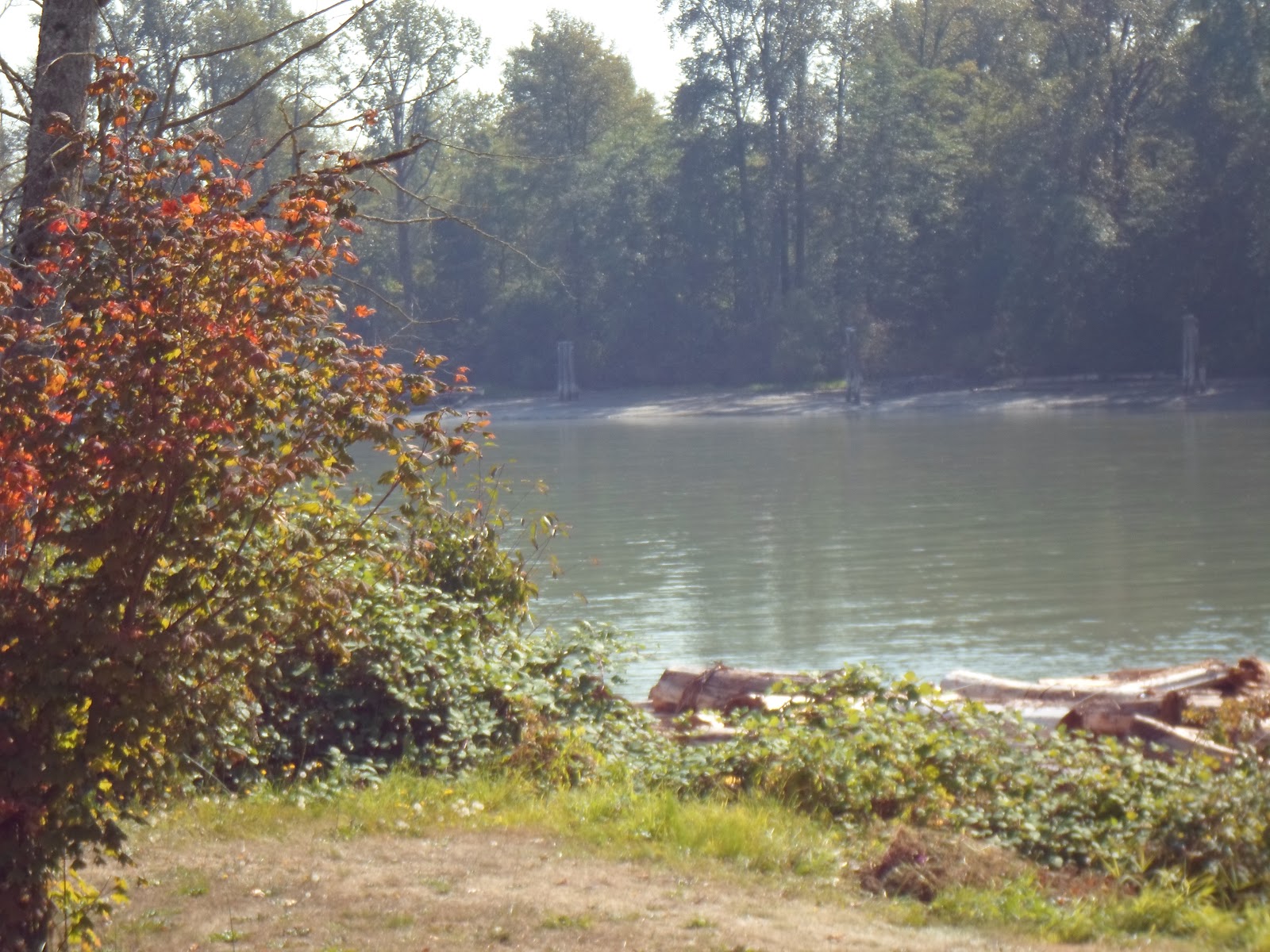
Hmmm. So far no 176 Street, which is the one Mr Google suggested I take. Seems like 96 turns into Golden Ears Way, and that would take me to Maple Ridge if I pedalled enough. Highway 1 would take me either to Vancouver over the Port Mann Bridge, or to St John's, Newfoundland. But I wasn't that energetic this morning. All I wanted was Barnston Island. I was looking forward to seeing the Barnston Island Herbs Company. Travelling down the road, I came to this underpass ...

.. and this hole in the wall. To me (and Stephen King, I would think) this is the underpass equivalent of having your foot stuck over the side of the bed at night. Even though our box spring is flat on the floor (Howard hasn't gotten around to putting the bed frame under it yet) I still can't have even my big toe hang over the edge of the bed, because I know something will reach out from somewhere to grab it, and I'll be finished. Or at least done for. However, I braved up, and Breehy sped me past it before any other-worldly creatures seeped through.

It was shortly after this I realized I was gone way past 176, even though I saw no signs reading 176. This is where I realized that, even though I knew where I was, I had no idea where I was or how to get where I was going. The only road I had crossed was Highway 15, the brand new upgraded one that turns into Highway 1 and travels across the Port Mann Bridge. FYI - if you do open this link, the first picture you see won't be the new Port Mann Bridge - it is a picture of the old one, which is the very same as the Patulla. Boy, do these bridges ever confuse me - as you probably know by now. The new Port Mann is the one below. I didn't take this picture.


'Would Highway 15 be 176 Street?'
YES! It would be!
So all I had to do was travel down Highway 15 (aka 176) to 104 and I'd be there! Almost! Ha. They were building a big overpass bridge a few metres down the highway, and guess what? They didn't have the sidewalk/bike lane open yet. What they did have was this:

One of these meant me. My only choice was to take the Hope exit and Hope I could hang a left and find 104 somewhere along the way. Double Ha. I ended up on another super highway, and guess what? I found a good thing - and a not-so-good thing. The good thing was this - I could imagine the spinster teacher on the steps ringing the bell - just like I did in the early 70's - the early 1970's that is.


So off I go. After a while, I do indeed come to Daly Road, and head down there for a few feet - before I considered - Google didn't say anything about Daly, and the kid didn't say go down Daly, he just said, watch for Daly. So I un-Dalyed and headed back to 104, where I finally found what I was looking for -


I don't think I'll try that. Maybe if it were a Whistler-Vancouver ride I might consider it. Downhill and all that.
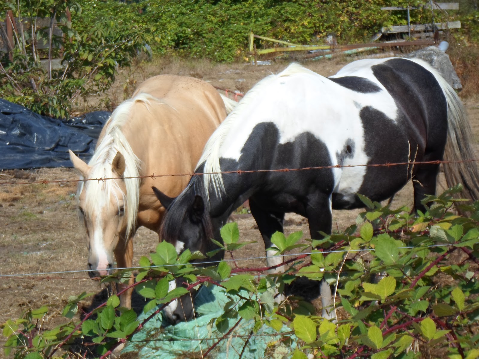
I saw horses.


Don't worry if your job seems small
Or if your pleasures few
Remember that the mighty oak
Was once a nut like you.
This was actually written in one of my autograph books by a then-young gal named Patsy Hall on October 30, 1969. She signed herself as The Lullaby Singer, but I really don't think she was. Looking back, I realize that I must have been the female version of Rodney Dangerfield - I obviously didn't get no respect, either.


A yard full of goats - there were more than these three. I wonder what they do with them when they mow the grass?


I had a long uphill, hot walk before I got going on Breehy again, but we finally did make it over the overhead walkway, and back to Tynehead Park. A bridge over a stream, you may think?


I think this day was a prime example of the saying - It's not the destination, it's the journey. If you think it's taking too long to read this blog - you can read it a lot faster than I did it - it took me about 7 hours - to ride, walk, enjoy, and complain about 41.3 kilometres, or 25 miles.

No comments:
Post a Comment